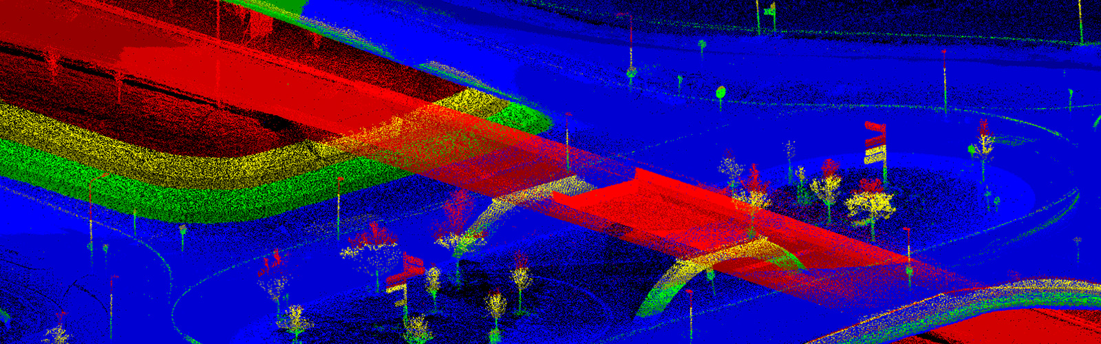
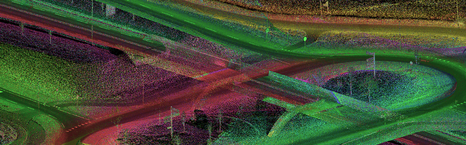
Terrestrial Mobile LiDAR or Mobile Mapping
LiDAR acquired from vehicle mounted scanners acquires very accurate inputs. These in turn server as precise inputs for the GIS industry for various projects with varied scope. Impulsions Laser has a team with profound experience in this domain. Our specialists extract features from LiDAR together with panoramic or 360 images and deliver highly accurate and precise data to meet our customer's needs.
We have processed many projects to different DOT standards with great preciseness. This include both road and rail corridor projects.
What we do with Mobile Laser Scans
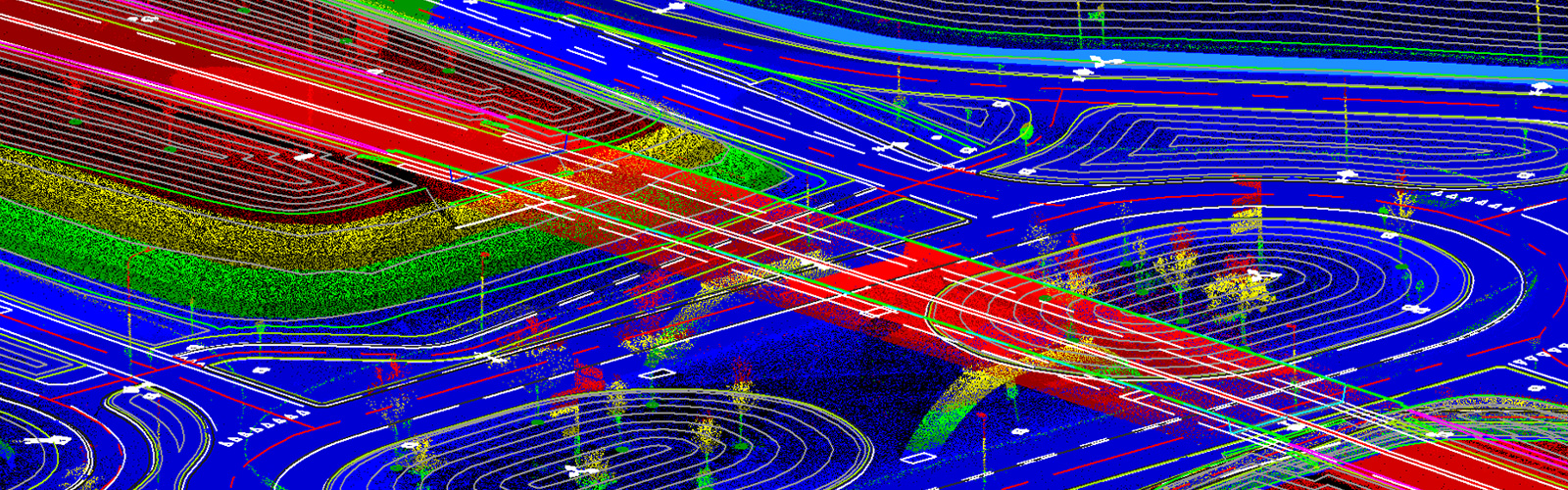
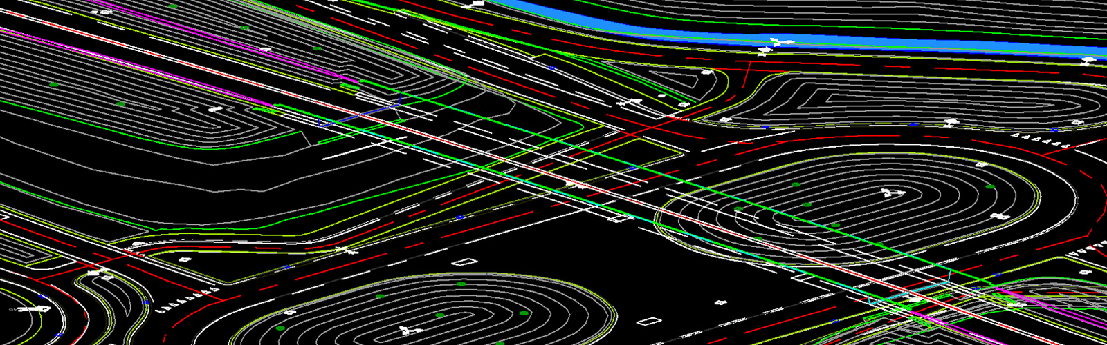
- Roadway surface including material changes and paint markings, curbs & gutters, medians, drains & ditches, access roads & driveways, parking lots, stairs, doorway entrances at base height to buildings and vegetation boundaries are vectored in 3D with the highest possible accuracy.
- Rail lines at base and top, rail centreline extracted from both rail tracks, sleepers, switches extracted iin 3D.
- Guard rails, fences, walls and building footprints are collected in 3D.
- Planters are extracted using breaklines to be included in the surface model.
- Road/rail embankments, abutments, bridges, viaducts and tunnels and slopes are shown in 3D using breaklines or profiles.
- Road/Rail signs and signals were symbolically presented at respective ground elevation with descriptive text.
- Railway platforms, signal houses and other technical buildings extracted in 3D. Electrical infra associated to rail are strung.
- Billboards, milepost markers, lamp posts, poles, fire hydrants, delineators, manholes, benches, trash bins, and utility boxes were placed at ground height with descriptions. Overhead utility lines are strung.
- Clearances for bridges, overhead signboards, gantries, overhead powerlines are measured and inserted to the project drawing.
- Key point grids at desired interval for open terrain, impervious surface, and roads are added and verified using LiDAR for accuracy so that they could be used for creation of the DTM.
Deliverable of a typical mobile mapping project includes:
- Accurate 3D topographic map for road or rail corridor
- TIN or Mesh model of the corridor in various format created from break lines and ground points.
- Major and minor contours at desired intervals
- Clearance reports of bridges and powerlines crossing roads and rails
- Accuracy report of extracted features to the point cloud provided.